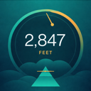
Know exactly how high you are.
Altimeter reads your elevation from GPS and your phone's barometer at once, then shows it on a gauge built to read at a glance - on the trail, in the cockpit, or out the window.
GPS knows roughly where you are.
The barometer knows how high.
A number you can trust.
Altimeter blends two independent sources - satellite positioning and air pressure - so your altitude reading holds steady where either one alone would drift.
Dual-source altitude.
GPS gives a global fix; the barometric sensor adds precision and responds the instant you climb or descend. On phones without a barometer, Altimeter falls back to GPS automatically.
Gauge or digital.
Read it as an elegant analog gauge or a crisp digital display - swipe to switch. A high-contrast layout stays legible in direct sunlight.
Coordinates, your way.
See your position in decimal, degrees-and-minutes, or degrees-minutes-seconds, and copy it to the clipboard with a tap.
Open it, and
read your height.
No sign-up, no setup. Grant location once and the live reading is on screen.
Get a fix.
Altimeter acquires GPS and reads the barometer, then settles on a single altitude with an accuracy estimate.
Record a session.
Track elevation over time with charts and per-session peak, gain, and duration - in the foreground or in the background.
Save or share.
Drop a named waypoint, share a branded snapshot, or export a whole session as GPX or CSV.
Built to read at a glance.
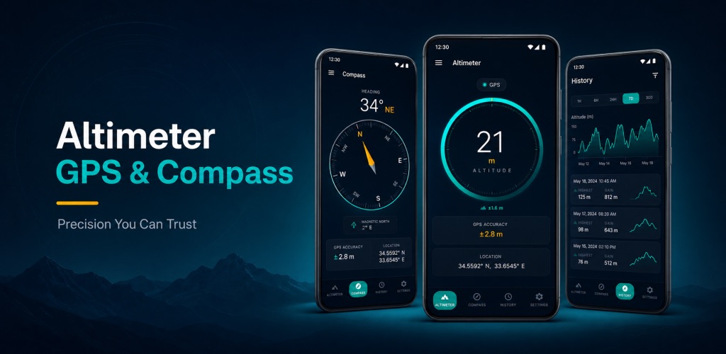
Compass, history, and alerts.
Altimeter is a small instrument set, not just a number - everything you'd want when the height matters.
True-north compass.
Heading, cardinal direction, coordinates, and altitude on one screen - with a magnetic-declination correction so true north really points north.
Altitude history.
Beautiful elevation charts and a session log you can scroll, review, and export. Your record of where you've been - up.
Altitude alerts.
Set a threshold and get a sound-and-vibration alert the moment you cross it - working in the background via a visible notification.
Named waypoints.
Save this spot with a name and come back to its altitude and coordinates later.
Share & export.
Share a branded altitude card, or export tracks as GPX for Google Earth, Strava, and Garmin - or CSV for a spreadsheet.
Metric or imperial.
Switch between feet and metres everywhere - altitude, accuracy, and history all follow your choice.
No account. No cloud sync.
Your altitude and location stay on your device.
The short version.
How accurate is the altitude?
Altimeter shows a live accuracy estimate with every reading. Where your phone has a barometric pressure sensor, it adds precision and reacts instantly to changes in height; on phones without one, the reading comes from GPS alone. Either way it's a consumer-grade instrument, not certified survey or aviation equipment.
Does it need an account or the internet?
No account, and no connection required to measure. Your altitude, history, waypoints, and settings live on your device.
What about tracking and analytics?
Crash reports and usage analytics are off by default. You can opt in during onboarding or in Settings → Privacy, and change your mind at any time. See the Privacy Policy.
Can I get my data out?
Yes. Export any session as a GPX 1.1 track for Google Earth, Strava, or Garmin, or as a CSV for spreadsheets - through your phone's normal share sheet.
Carry an altimeter in your pocket.
Precise altitude, a true-north compass, and a track you can keep. Free on Android.
GET IT ON Google PlayAltimeter is a consumer measurement tool. Its altitude, accuracy, heading, and coordinate readings are informational and must not be relied upon for aviation, marine, mountaineering safety, surveying, or any situation where an error could cause harm. Always use certified instruments for navigation and safety-critical decisions.